File:Europe countries map en 3.jpg
From Quiz Revision Notes
Size of this preview: 737 × 599 pixels. Other resolutions: 295 × 240 pixels | 590 × 480 pixels | 738 × 600 pixels | 944 × 768 pixels | 1,259 × 1,024 pixels | 1,473 × 1,198 pixels.
Original file (1,473 × 1,198 pixels, file size: 543 KB, MIME type: image/jpeg)
Summary
| Description |
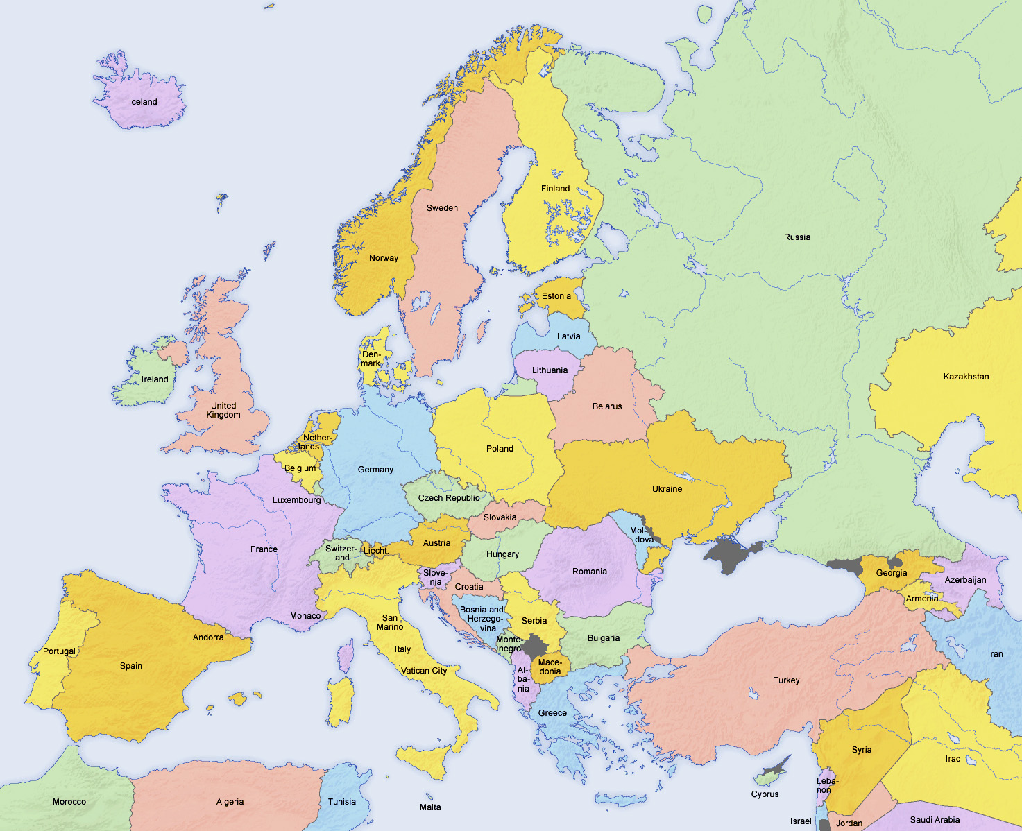
English: Map of countries in Europe and the surrounding region |
| Date | |
| Source | https://en.wikipedia.org/wiki/List_of_sovereign_states_and_dependent_territories_in_Europe#/media/File:Europe_countries_map_en_2.png |
| Author | San Jose (map), Hayden120 (retouch) - Derivative work of Europe countries map en.png by San Jose, based on the Generic Mapping Tools and ETOPO2 |
Licensing
This file is licensed under the Creative Commons Attribution-Share Alike 3.0 Unported licence.
- You are free:
- to share – to copy, distribute and transmit the work
- to remix – to adapt the work
- Under the following conditions:
- attribution – You must give appropriate credit, provide a link to the licence, and indicate if changes were made. You may do so in any reasonable manner, but not in any way that suggests the licensor endorses you or your use.
- share alike – If you remix, transform, or build upon the material, you must distribute your contributions under the same or compatible licence as the original.
File history
Click on a date/time to view the file as it appeared at that time.
| Date/Time | Thumbnail | Dimensions | User | Comment | |
|---|---|---|---|---|---|
| current | 19:43, 17 November 2020 | | 1,473 × 1,198 (543 KB) | AzadJamalMuroff | Uploaded a work by San Jose (map), Hayden120 (retouch) - Derivative work of Europe countries map en.png by San Jose, based on the Generic Mapping Tools and ETOPO2 from https://en.wikipedia.org/wiki/List_of_sovereign_states_and_dependent_territories_in_Europe#/media/File:Europe_countries_map_en_2.png with UploadWizard |
File usage
The following page links to this file: