Difference between revisions of "Civilisation/World Geography - Oceania and Antarctica"
(Added content) |
(Brought up to date) |
||
| (7 intermediate revisions by the same user not shown) | |||
| Line 1: | Line 1: | ||
Opinions of what constitutes Oceania range from its three subregions of Melanesia, Micronesia, and Polynesia to, more broadly, the entire insular region between Asia and the Americas, including Australasia and the Malay Archipelago. The term is often used more specifically to denote a continent comprising Australia and proximate islands | Opinions of what constitutes Oceania range from its three subregions of Melanesia, Micronesia, and Polynesia to, more broadly, the entire insular region between Asia and the Americas, including Australasia and the Malay Archipelago. The term is often used more specifically to denote a continent comprising Australia and proximate islands | ||
| − | [[File:Oceania UN Geoscheme - Map with Zones.svg|none|thumb]] | + | [[File:Oceania UN Geoscheme - Map with Zones.svg|none|thumb|800x800px|link=Special:FilePath/Oceania_UN_Geoscheme_-_Map_with_Zones.svg|alt=]] |
| − | '''Melanesia''' consists of the four countries of | + | '''Melanesia''' consists of the four countries of Vanuatu, Solomon Islands, Fiji, and Papua New Guinea |
'''Micronesia''' region encompasses the country Micronesia, the four other sovereign, independent nations – Kiribati, Marshall Islands, Nauru, and Palau – as well as three U.S. territories – Guam, Northern Mariana Islands, and Wake Island | '''Micronesia''' region encompasses the country Micronesia, the four other sovereign, independent nations – Kiribati, Marshall Islands, Nauru, and Palau – as well as three U.S. territories – Guam, Northern Mariana Islands, and Wake Island | ||
| Line 48: | Line 48: | ||
· Heard Island and McDonald Islands | · Heard Island and McDonald Islands | ||
| + | |||
| + | Mawson Peak is an active volcanic summit of the Big Ben massif on Heard Island. It is higher than Mount Kosciuszko | ||
· Jervis Bay Territory, a naval base and sea port for the national capital in land that was formerly part of New South Wales | · Jervis Bay Territory, a naval base and sea port for the national capital in land that was formerly part of New South Wales | ||
| Line 67: | Line 69: | ||
Ove Arup were the structural engineers on Sydney Opera House, designed by Jorn Utzon | Ove Arup were the structural engineers on Sydney Opera House, designed by Jorn Utzon | ||
| − | Parramatta | + | Taronga Zoo is in Sydney |
| + | |||
| + | Cockatoo Island in Sydney operated as a convict penal establishment | ||
| + | |||
| + | Port Jackson, consisting of the waters of Sydney Harbour, Middle Harbour, North Harbour and the Lane Cove and Parramatta Rivers, is the ria or natural harbour of Sydney | ||
Wagga Wagga straddles the Murrumbidgee River | Wagga Wagga straddles the Murrumbidgee River | ||
| Line 109: | Line 115: | ||
Kuranda Scenic Railway runs from Cairns into the tropical rainforest | Kuranda Scenic Railway runs from Cairns into the tropical rainforest | ||
| − | Daintree | + | Daintree Rainforest is a part of the Wet Tropics of Queensland Rainforest, that spans across the Cairns Region |
Whitsunday Islands are a collection of continental islands of various sizes off the central coast of Queensland | Whitsunday Islands are a collection of continental islands of various sizes off the central coast of Queensland | ||
| Line 150: | Line 156: | ||
Capital – Melbourne | Capital – Melbourne | ||
| + | |||
| + | Victoria is the most densely populated state | ||
Tullamarine airport serves Melbourne | Tullamarine airport serves Melbourne | ||
| Line 157: | Line 165: | ||
Melbourne is named after the Prime Minister Lord Melbourne | Melbourne is named after the Prime Minister Lord Melbourne | ||
| − | Melbourne was capital of Australia until 1927 | + | Melbourne was the capital of Australia until 1927 |
| + | |||
| + | St Kilda is an inner seaside suburb in Melbourne | ||
Ballarat and Geelong are towns in Victoria | Ballarat and Geelong are towns in Victoria | ||
| Line 170: | Line 180: | ||
Great Ocean Road (known as the Surfcoast Highway) stretches along the southeastern coast of Australia between the Victorian cities of Torquay and Warrnambool. After Apollo Bay the road passes through the Great Otway National Park, which includes some of the last surviving rain forests in the south of Australia | Great Ocean Road (known as the Surfcoast Highway) stretches along the southeastern coast of Australia between the Victorian cities of Torquay and Warrnambool. After Apollo Bay the road passes through the Great Otway National Park, which includes some of the last surviving rain forests in the south of Australia | ||
| − | |||
| − | |||
| − | |||
| − | |||
'''Western Australia''' | '''Western Australia''' | ||
| Line 191: | Line 197: | ||
Rudall River National Park and Karijini National Park are in Western Australia | Rudall River National Park and Karijini National Park are in Western Australia | ||
| − | Bibbulmun Track is a long distance walk trail | + | Bibbulmun Track is a long distance walk trail. It runs from Perth to Albany and is almost 1000 km long |
| − | Kimberley | + | Kimberley is the northernmost of the nine regions of Western Australia. The region was named after John Wodehouse, 1st Earl of Kimberley. One third of the world's annual production of diamonds is mined at the Argyle and the Ellendale diamond mines |
Bradshaw rock paintings are rock art found in the north-west Kimberley region | Bradshaw rock paintings are rock art found in the north-west Kimberley region | ||
| − | |||
| − | |||
Mandurah is second largest city in Western Australia | Mandurah is second largest city in Western Australia | ||
| Line 211: | Line 215: | ||
Ningaloo Reef fringes the Ningaloo Coast | Ningaloo Reef fringes the Ningaloo Coast | ||
| − | Shark Bay is a World Heritage Site | + | Shark Bay is on the westernmost point of the Australian continent and is a World Heritage Site |
| + | |||
| + | Wolfe Creek Crater is a meteorite impact crater in Western Australia | ||
'''Tasmania''' | '''Tasmania''' | ||
| Line 261: | Line 267: | ||
The territory was transferred to the Commonwealth by the state of New South Wales in 1911, two years prior to the naming of Canberra as the national capital in 1913 | The territory was transferred to the Commonwealth by the state of New South Wales in 1911, two years prior to the naming of Canberra as the national capital in 1913 | ||
| − | The Lodge is the residence of the prime minister | + | The Lodge is the residence of the prime minister |
Lake Burley Griffin is an artificial lake in Canberra. It is named after Walter Burley Griffin, the American architect who won the competition to design the city of Canberra | Lake Burley Griffin is an artificial lake in Canberra. It is named after Walter Burley Griffin, the American architect who won the competition to design the city of Canberra | ||
| − | Telstra Tower is a telecommunications tower that is situated above the summit of Black Mountain | + | Telstra Tower is a telecommunications tower that is situated above the summit of Black Mountain |
<u>Deserts</u> | <u>Deserts</u> | ||
| Line 291: | Line 297: | ||
| − | Norfolk Island is in the Pacific Ocean, located between Australia, New Zealand and New Caledonia. The island is part of the Commonwealth of Australia, and enjoys a large degree of self-governance | + | Norfolk Island is in the Pacific Ocean, located between Australia, New Zealand and New Caledonia. The island is part of the Commonwealth of Australia, and enjoys a large degree of self-governance. Capital – Kingston. Largest town – Burnt Pine |
| − | Lord Howe Island is a small island in the Pacific Ocean 600 km east of the Australian mainland administered by New South Wales | + | Lord Howe Island is a small island in the Pacific Ocean 600 km east of the Australian mainland. It is administered by New South Wales |
| − | Macquarie Island lies in the southwest Pacific Ocean, | + | Macquarie Island lies in the southwest Pacific Ocean, halfway between New Zealand and Antarctica. It is administered by Tasmania |
Great Barrier Reef is the world's largest coral reef system composed of over 2,900 individual reefs and 900 islands stretching for over 2,300 km. The reef is located in the Coral Sea, off the coast of Queensland. The Great Barrier Reef can be seen from outer space and is the world's biggest single structure made by living organisms | Great Barrier Reef is the world's largest coral reef system composed of over 2,900 individual reefs and 900 islands stretching for over 2,300 km. The reef is located in the Coral Sea, off the coast of Queensland. The Great Barrier Reef can be seen from outer space and is the world's biggest single structure made by living organisms | ||
| − | Bass Strait separates Tasmania from the Australian mainland, specifically the state of Victoria. Named by Matthew Flinders | + | Bass Strait separates Tasmania from the Australian mainland, specifically the state of Victoria. Named after George Bass, by Matthew Flinders |
Flinders Island lies in the Bass Strait | Flinders Island lies in the Bass Strait | ||
| Line 305: | Line 311: | ||
Great Australian Bight is a large bight, or open bay, off the central and western portions of the southern coastline of mainland Australia. It was once joined to Antarctica | Great Australian Bight is a large bight, or open bay, off the central and western portions of the southern coastline of mainland Australia. It was once joined to Antarctica | ||
| − | Cape Howe is a coastal headland in Australia, forming the border of New South Wales and Victoria. The point was named by Captain Cook when he passed it in 1770, honouring Richard Howe, 1st Earl Howe who was Treasurer of the Navy at that time | + | Cape Howe is a coastal headland in Australia, forming the border of New South Wales and Victoria. The point was named by Captain Cook when he passed it in 1770, honouring Richard Howe, 1st Earl Howe, who was Treasurer of the Navy at that time |
Nullarbor Plain is a vast area of flat, almost treeless, arid or semi-arid country immediately north of the Great Australian Bight. It is the world's largest single piece of limestone, and occupies an area of about 200,000 km². Nullarbor means “no tree” | Nullarbor Plain is a vast area of flat, almost treeless, arid or semi-arid country immediately north of the Great Australian Bight. It is the world's largest single piece of limestone, and occupies an area of about 200,000 km². Nullarbor means “no tree” | ||
| Line 315: | Line 321: | ||
Indian Pacific is a weekly passenger rail service running between Sydney and Perth. The route includes the world's longest straight stretch of railway track, a 478 kilometre stretch over the Nullarbor Plain | Indian Pacific is a weekly passenger rail service running between Sydney and Perth. The route includes the world's longest straight stretch of railway track, a 478 kilometre stretch over the Nullarbor Plain | ||
| − | + | The first railway line linking North and South Australia opened in 2004, between Adelaide and Darwin. The passenger train known as 'The Ghan' operates on the railway | |
| − | |||
| − | |||
Stuart Highway runs from Darwin, in the Northern Territory, to Port Augusta in South Australia | Stuart Highway runs from Darwin, in the Northern Territory, to Port Augusta in South Australia | ||
| Line 389: | Line 393: | ||
Marshall Islands are part of the larger island group of Micronesia | Marshall Islands are part of the larger island group of Micronesia | ||
| − | |||
| − | |||
| − | |||
| − | |||
| − | |||
| − | |||
| − | |||
| − | |||
| − | |||
| − | |||
The most populous atoll is Majuro, which also acts as the capital | The most populous atoll is Majuro, which also acts as the capital | ||
| Line 454: | Line 448: | ||
Nauru is the smallest republic in the world | Nauru is the smallest republic in the world | ||
| + | |||
| + | Yaren is usually listed as the capital of Nauru. However, the republic does not have cities or an official capital. Yaren is accepted by the United Nations as the "main district" | ||
== New Zealand == | == New Zealand == | ||
| Line 506: | Line 502: | ||
Baldwin Street in Dunedin claims to be the world’s steepest residential street, although this is challenged by Ffordd Pen Llech in Harlech, Wales | Baldwin Street in Dunedin claims to be the world’s steepest residential street, although this is challenged by Ffordd Pen Llech in Harlech, Wales | ||
| + | |||
| + | Queenstown in Otago is an adventure tourism resort. Kawarau Gorge Suspension Bridge was the world's first commercial bungy jumping site | ||
Bay of Islands is on North Island. Home of the first Maori settlers, and site of the signing of the Treaty of Waitangi | Bay of Islands is on North Island. Home of the first Maori settlers, and site of the signing of the Treaty of Waitangi | ||
| Line 538: | Line 536: | ||
==== Cook Islands ==== | ==== Cook Islands ==== | ||
| − | Cook Islands | + | [[File:Flag of the Cook Islands.png|center|thumb]] |
| + | |||
| + | |||
| + | |||
| + | The stars on the flag of the Cook Islands represent the fifteen islands that make up the Cook Islands | ||
| − | + | The Cook Islands' defence and foreign affairs are the responsibility of New Zealand. | |
| − | |||
| − | + | The main population centres are on the island of Rarotonga. Avarua is the capital | |
| − | ==== | + | ==== Niue ==== |
| − | + | [[File:Flag of Niue.png|center|thumb]] | |
| + | Niue is the largest coral island in the world. Known as the “Rock of Polynesia”. Though self-governing, Niue lacks full sovereignty. In 2003, Niue became the world's first ‘WiFi nation’, in which free wireless Internet access is provided throughout the country | ||
| + | Alofi is the capital | ||
| + | In 2020 Niue became the first whole country to become an International Dark Sky Place | ||
| − | + | === Dependent territories of New Zealand === | |
| − | + | ==== Tokelau ==== | |
| + | Tokelau is a dependent territory of New Zealand in the South Pacific Ocean that consists of three tropical coral atolls | ||
| − | |||
| − | + | New Zealand outlying islands are nine offshore island groups that are part of New Zealand. The islands are all uninhabited except the Chatham Islands | |
<u>Chatham Islands</u> | <u>Chatham Islands</u> | ||
| − | Have officially belonged to New Zealand since 1842. They cover a total of 966 km², most of which is in the two main islands, Chatham Island and Pitt Island. Chatham Island is the fourth largest island of New Zealand. Chatham Islands observe their own time, 45 minutes ahead of New Zealand time | + | Have officially belonged to New Zealand since 1842. They cover a total of 966 km², most of which is in the two main islands, Chatham Island and Pitt Island. Chatham Island is the fourth largest island of New Zealand. Chatham Islands observe their own time, 45 minutes ahead of New Zealand time. The islands include New Zealand's easternmost point, the Forty-Fours |
== Palau == | == Palau == | ||
| Line 609: | Line 613: | ||
Bismarck Range is a mountain range in the central highlands of Papua New Guinea; the highest point is Mount Wilhelm | Bismarck Range is a mountain range in the central highlands of Papua New Guinea; the highest point is Mount Wilhelm | ||
| − | Carteret Islands are | + | Carteret Islands are located near Bougainville in the South Pacific. The atoll is a scattering of low lying islands in a horseshoe shape. The islands have progressively become uninhabitable, due to flooding |
New Britain is the largest island in the Bismarck Archipelago (named after Otto von Bismarck) of Papua New Guinea. The island was part of German New Guinea | New Britain is the largest island in the Bismarck Archipelago (named after Otto von Bismarck) of Papua New Guinea. The island was part of German New Guinea | ||
| Line 615: | Line 619: | ||
848 languages are listed for the country | 848 languages are listed for the country | ||
| − | Sepik and Fly are the longest rivers. Fly | + | Sepik and Fly are the longest rivers. Fly is the largest river by discharge in Oceania |
Trobriand Islands are an archipelago of coral atolls off the east coast of New Guinea | Trobriand Islands are an archipelago of coral atolls off the east coast of New Guinea | ||
| + | |||
| + | Raggiana Bird of Paradise is known as a kumul in New Guinea | ||
== Samoa == | == Samoa == | ||
| Line 668: | Line 674: | ||
Named after the biblical king Solomon | Named after the biblical king Solomon | ||
| − | + | King Charles III is the Monarch of the Solomon Islands and the head of state; he is represented by the Governor-General | |
== Tonga == | == Tonga == | ||
| Line 719: | Line 725: | ||
The capital of Tuvalu is sometimes given as Fongafale or Vaiaku, but the entire atoll of Funafuti is officially the capital | The capital of Tuvalu is sometimes given as Fongafale or Vaiaku, but the entire atoll of Funafuti is officially the capital | ||
| − | The ".tv" domain name generates around | + | The ".tv" domain name generates around 8% of the government’s total revenue each year from royalties |
Niulakita is 4.6m above sea level | Niulakita is 4.6m above sea level | ||
| Line 741: | Line 747: | ||
In the 1880s, France and the United Kingdom claimed parts of the archipelago, and in 1906 they agreed on a framework for jointly managing the archipelago as the New Hebrides through a British–French Condominium. An independence movement arose in the 1970s, and the Republic of Vanuatu was founded in 1980 | In the 1880s, France and the United Kingdom claimed parts of the archipelago, and in 1906 they agreed on a framework for jointly managing the archipelago as the New Hebrides through a British–French Condominium. An independence movement arose in the 1970s, and the Republic of Vanuatu was founded in 1980 | ||
| − | Port Vila | + | Port Vila is located on the island of Efate |
| − | Tanna is an island of Vanuatu, and is at the centre of the Jon Frum cargo cult which | + | Tanna is an island of Vanuatu, and is at the centre of the Jon Frum cargo cult which worshipped Prince Philip, the Duke of Edinburgh |
Mount Yasur is an active volcano on Tanna | Mount Yasur is an active volcano on Tanna | ||
| Line 764: | Line 770: | ||
Louis-Antoine de Bougainville's name is given to Bougainville which is geographically part of the Solomon Islands, but politically Papua New Guinea; and to the strait which divides it from the island of Choiseul | Louis-Antoine de Bougainville's name is given to Bougainville which is geographically part of the Solomon Islands, but politically Papua New Guinea; and to the strait which divides it from the island of Choiseul | ||
| − | In a 2019 referendum Bougainville voted for independence from Papua New Guinea | + | In a 2019 referendum Bougainville voted for independence from Papua New Guinea. As a result, the regional authorities intend to become independent between 2025 and 2027, pending ratification by the Papua New Guinean government |
<u>Caroline Islands</u> | <u>Caroline Islands</u> | ||
| Line 786: | Line 792: | ||
Papeete, on Tahiti, is the capital of French Polynesia | Papeete, on Tahiti, is the capital of French Polynesia | ||
| − | Bora Bora | + | Bora Bora and Moorea are islands in the Society Islands archipelago |
Society Islands are divided into Leeward Islands and Windward Islands | Society Islands are divided into Leeward Islands and Windward Islands | ||
| Line 798: | Line 804: | ||
Mariana Islands are an arc-shaped archipelago made up by the summits of fifteen volcanic mountains in the Pacific Ocean. They are composed of two administrative units, Guam, a US territory, and the Northern Mariana Islands (including the islands of Saipan, Tinian and Rota) which make up a Commonwealth of the United States | Mariana Islands are an arc-shaped archipelago made up by the summits of fifteen volcanic mountains in the Pacific Ocean. They are composed of two administrative units, Guam, a US territory, and the Northern Mariana Islands (including the islands of Saipan, Tinian and Rota) which make up a Commonwealth of the United States | ||
| − | Guam was discovered by Magellan, and was formerly a Spanish territory | + | Guam was discovered by Ferdinand Magellan, and was formerly a Spanish territory |
| + | |||
| + | Guam is the largest and southernmost of the Mariana Islands. The capital is Hagatna | ||
| − | + | Challenger Deep is the deepest known point in the Earth's sea floor hydrosphere, with a depth of 10,898 m. It is in the Pacific Ocean, at the southern end of the Mariana Trench near the Mariana Islands group | |
| + | |||
| + | Mariana Trench belongs jointly to a commonwealth of the United States and Federated States of Micronesia | ||
<u>Pitcairn Islands</u> | <u>Pitcairn Islands</u> | ||
| Line 841: | Line 851: | ||
== Antarctica == | == Antarctica == | ||
| + | [[File:Antarctica.svg|center|thumb|600x600px|alt=]] | ||
| + | |||
| + | |||
| + | |||
| + | Antarctica has the highest average elevation of all the continents | ||
| + | |||
| + | Australia has the largest territorial claim by area in Antarctica | ||
| + | |||
| + | Belief by Europeans in the existence of a Terra Australis – a vast continent in the far south of the globe to balance the northern lands of Europe, Asia and North Africa – had existed as an intellectual concept since classical antiquity | ||
| + | |||
Antarctica is considered a desert, with annual precipitation of only 200 mm along the coast and far less inland | Antarctica is considered a desert, with annual precipitation of only 200 mm along the coast and far less inland | ||
| Line 846: | Line 866: | ||
British Antarctic Territory is a British overseas territory, the sector of Antarctica claimed by the United Kingdom from the South Pole to 60° south latitude between longitudes 20° west and 80° west. Before 1962, the area now covered by the Territory comprised three separate dependencies of the Falkland Islands; Graham Land, the South Orkney Islands, and the South Shetland Islands | British Antarctic Territory is a British overseas territory, the sector of Antarctica claimed by the United Kingdom from the South Pole to 60° south latitude between longitudes 20° west and 80° west. Before 1962, the area now covered by the Territory comprised three separate dependencies of the Falkland Islands; Graham Land, the South Orkney Islands, and the South Shetland Islands | ||
| + | |||
| + | Deception Island is an island in the South Shetland Islands | ||
Ross Dependency is a region of Antarctica defined by a sector originating at the South Pole, passing along longitudes 160° east to 150° west, and terminating at latitude 60° south. It is claimed by New Zealand | Ross Dependency is a region of Antarctica defined by a sector originating at the South Pole, passing along longitudes 160° east to 150° west, and terminating at latitude 60° south. It is claimed by New Zealand | ||
| − | |||
| − | |||
Graham Land and Palmer Land are the northern and southern portions of the Antarctic Peninsula | Graham Land and Palmer Land are the northern and southern portions of the Antarctic Peninsula | ||
| Line 858: | Line 878: | ||
Scott's Hut is a building located on the north shore of Cape Evans on Ross Island in Antarctica. It was erected in 1911 by the British Antarctic Expedition of 1910–1913 (also known as the Terra Nova Expedition) led by Robert Falcon Scott | Scott's Hut is a building located on the north shore of Cape Evans on Ross Island in Antarctica. It was erected in 1911 by the British Antarctic Expedition of 1910–1913 (also known as the Terra Nova Expedition) led by Robert Falcon Scott | ||
| + | |||
| + | Scott Base is a New Zealand research facility on Ross Island | ||
| + | |||
| + | Mount Ellsworth and Lake Ellsworth are named after American polar explorer Lincoln Ellsworth | ||
| + | |||
| + | Halley Research Station, run by the British Antarctic Survey, is located on the Brunt Ice Shelf floating on the Weddell Sea. It is the first fully relocatable research station in the world | ||
| + | |||
| + | Queen Maud Land is claimed by Norway as a dependent territory. Named after the Norwegian queen Maud of Wales | ||
| + | |||
| + | Marie Byrd Land is the largest unclaimed territory on Earth. It was named after the wife of American naval officer and explorer Richard E. Byrd | ||
| + | |||
| + | Onyx River is the longest river | ||
| + | |||
| + | McMurdo Dry Valleys are a row of largely snow-free valleys, located within Victoria Land | ||
| + | |||
| + | Argentina and Chile have civilian settlements | ||
| + | |||
| + | The world’s most remote post office can be found in Port Lockroy | ||
| + | |||
| + | |||
<u>Mountains</u> | <u>Mountains</u> | ||
| Line 863: | Line 903: | ||
The three largest mountain ranges on the Antarctic continent are the Transantarctic Mountains, the West Antarctica Ranges, and the East Antarctica Ranges | The three largest mountain ranges on the Antarctic continent are the Transantarctic Mountains, the West Antarctica Ranges, and the East Antarctica Ranges | ||
| − | Highest mountains | + | Highest mountains – Vinson Massif, Mount Tyree, Mount Shinn |
| + | |||
| + | Vinson Massif lies in the Sentinel Range of the Ellsworth Mountains, which stand above the Ronne Ice Shelf near the base of the Antarctic Peninsula | ||
| + | |||
| + | Mount Erebus is the southernmost active volcano on Earth. With a summit elevation of 3795 m, it is located on Ross Island. Mount Erebus was first climbed (to the rim) by members of Sir Ernest Shackleton's party in 1908. Mount Erebus was discovered in1841 by polar explorer James Clark Ross who named it Mount Erebus after his ships, ''Erebus'' and ''Terror''. Erebus was a primordial Greek god of darkness, the son of Chaos | ||
| − | + | Mount McClintock is part of the Australian Antarctic Territory, and is higher than all peaks of Australia, including all external territories | |
| − | |||
<u>Lakes</u> | <u>Lakes</u> | ||
| Line 875: | Line 918: | ||
Lake Ellsworth is a subglacial lake located in West Antarctica under approximately 3.4 km of ice | Lake Ellsworth is a subglacial lake located in West Antarctica under approximately 3.4 km of ice | ||
| − | Lake Vida is a hypersaline lake | + | Lake Vida is a hypersaline lake. It came to public attention in 2002 when microbes frozen in its ice cover for more than 2,800 years were successfully thawed and reanimated |
| − | |||
| − | |||
| − | |||
| − | |||
<u>Seas</u> | <u>Seas</u> | ||
| − | Weddell Sea is an area along the east side of the Antarctic Peninsula | + | Weddell Sea is an area along the east side of the Antarctic Peninsula. Named after British sailor James Weddell |
| + | |||
| + | Larsen Ice Shelf is a long ice shelf in the northwest part of the Weddell Sea | ||
Bellingshausen Sea is an area along the west side of the Antarctic Peninsula. It takes its name from Russian explorer Admiral Bellingshausen, who explored in the area in 1821 | Bellingshausen Sea is an area along the west side of the Antarctic Peninsula. It takes its name from Russian explorer Admiral Bellingshausen, who explored in the area in 1821 | ||
| − | Amundsen Sea lies to the south of Bellingshausen Sea | + | Alexander Island is the largest island of Antarctica. It lies in the Bellingshausen Sea |
| + | |||
| + | Amundsen Sea lies to the south of the Bellingshausen Sea | ||
| − | Ross Sea is a deep bay of the Southern Ocean | + | Ross Sea is a deep bay of the Southern Ocean between Victoria Land and Marie Byrd Land |
McMurdo Sound opens into the Ross Sea to the north | McMurdo Sound opens into the Ross Sea to the north | ||
Wilkins Sound is largely occupied by the Wilkins Ice Shelf. In 2009 the thin bridge of ice to the Wilkins Ice Shelf off the coast of Antarctica splintered, and scientists expect it could cause the collapse of the Shelf | Wilkins Sound is largely occupied by the Wilkins Ice Shelf. In 2009 the thin bridge of ice to the Wilkins Ice Shelf off the coast of Antarctica splintered, and scientists expect it could cause the collapse of the Shelf | ||
| + | |||
| + | Shackleton Ice Shelf is an extensive ice shelf fronting the coast of East Antarctica | ||
| + | |||
| + | |||
| + | |||
| + | <u>Glaciers</u> | ||
| + | |||
| + | Lambert Glacier is in East Antarctica. At about 60 miles wide, over 250 miles long, and about 2,500 m deep, it is the world's largest glacier | ||
| + | |||
| + | Beardmore Glacier has a length exceeding 160 km. The glacier is one of the main passages from the Ross Ice Shelf through the Queen Alexandra and Commonwealth ranges of the Transantarctic Mountains to the Antarctic Plateau, and was one of the early routes to the South Pole. The glacier was discovered by Ernest Shackleton during his Nimrod Antarctic expedition of 1908 | ||
Latest revision as of 16:37, 13 July 2023
Opinions of what constitutes Oceania range from its three subregions of Melanesia, Micronesia, and Polynesia to, more broadly, the entire insular region between Asia and the Americas, including Australasia and the Malay Archipelago. The term is often used more specifically to denote a continent comprising Australia and proximate islands
Melanesia consists of the four countries of Vanuatu, Solomon Islands, Fiji, and Papua New Guinea
Micronesia region encompasses the country Micronesia, the four other sovereign, independent nations – Kiribati, Marshall Islands, Nauru, and Palau – as well as three U.S. territories – Guam, Northern Mariana Islands, and Wake Island
Polynesia made up of over 1,000 islands scattered over the central and southern Pacific Ocean. Includes Samoa, Tonga, and Tuvalu
Highest mountains in Oceania – Carstensz Pyramid (Puncak Jaya), Julianatop (Puncak Mandala), Puncak Trikora. All in the Indonesian part of New Guinea
Arafura Sea lies west of the Pacific Ocean overlying the continental shelf between Australia and New Guinea
Torres Strait lies between Australia and New Guinea. It is named after navigator Luis Vaz de Torres who passed through the Strait in 1606
The deepest point of the Tonga Trench, the Horizon Deep, is the deepest point in the Southern Hemisphere and the second deepest on Earth after the Challenger Deep in the Mariana Trench
Australia
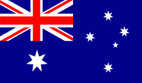
Flag of Australia has a seven-pointed star (the Commonwealth Star) and a representation of the Southern Cross, made up of five stars (four large stars and a small star)
| Capital | Canberra |
| Largest cities | Sydney, Melbourne, Brisbane, Perth, Adelaide |
| Currency | Dollar |
| Highest point | Mount Kosciuszko |
Australia is the world's sixth largest country by total area
Australia has six states – New South Wales, Queensland, South Australia, Victoria, Western Australia, and Tasmania; and two major mainland territories – Northern Territory, and the Australian Capital Territory (ACT)
The federal parliament directly administers the following territories:
· Ashmore and Cartier Islands
· Australian Antarctic Territory
· Christmas Island, located 1,600 miles northwest of Perth
· Cocos (Keeling) Islands, located in the Indian Ocean, half way between Australia and Sri Lanka
· Coral Sea Islands
· Heard Island and McDonald Islands
Mawson Peak is an active volcanic summit of the Big Ben massif on Heard Island. It is higher than Mount Kosciuszko
· Jervis Bay Territory, a naval base and sea port for the national capital in land that was formerly part of New South Wales
New South Wales
Capital – Sydney
New South Wales was named by James Cook
Stingray Harbour was renamed to Botany Bay, after botanist Joseph Banks
Kingsford Smith airport serves Sydney
Sydney is named in honour of Thomas Townshend, 1st Viscount Sydney
Sydney Harbour Bridge was designed by John Bradfield. It spans Port Jackson, and the road across the bridge is known as the Bradfield Highway. Built by Dorman Long and Co Ltd, Middlesbrough and opened in 1932
Ove Arup were the structural engineers on Sydney Opera House, designed by Jorn Utzon
Taronga Zoo is in Sydney
Cockatoo Island in Sydney operated as a convict penal establishment
Port Jackson, consisting of the waters of Sydney Harbour, Middle Harbour, North Harbour and the Lane Cove and Parramatta Rivers, is the ria or natural harbour of Sydney
Wagga Wagga straddles the Murrumbidgee River
Lightning Ridge is a world centre of the mining of black opals
Liverpool Plains are an extensive agricultural area covering approximately 1.2 million hectares of the northwestern slopes of New South Wales
Mount Kosciusko is in the Snowy Mountains, and is the highest mountain in Australia. Named in honour of a Polish national hero
Mount Townsend is the second highest mountain in Australia
Wentworth lies at the confluence of Australia's two most important rivers, the Darling and the Murray
Wollongong is a seaside city located in the Illawarra region of New South Wales
The Blue Mountains region borders on Sydney’s metropolitan area. Named after the blue haze caused by chemicals emitted by eucalyptus trees. The Three Sisters are a rock formation close to the town of Katoomba above the Jamison Valley
Queensland
Capital – Brisbane
Brisbane is on the River Brisbane
Brisbane is named after Major-General Sir Thomas Brisbane, who was Governor of New South Wales from 1821 to 1825
Brisbane is known as the “world’s largest country town”
Gold Coast is the largest non-state capital and the sixth-largest city in Australia
Q1 (abbreviation of Queensland Number One) is a skyscraper in Surfers Paradise, on the Gold Coast. Q1 is the tallest building in Australia and the Southern Hemisphere
Cape York Peninsula is a large remote peninsula located in Far North Queensland
Cape Melville is a headland on the eastern coast of the Cape York Peninsula. The fauna and flora found near Cape Melville is diverse and includes several endemic species
Queensland has the world’s oldest rainforests
Cairns is located on the east coast of Cape York Peninsula on a coastal strip between the Coral Sea and the Great Dividing Range
Kuranda Scenic Railway runs from Cairns into the tropical rainforest
Daintree Rainforest is a part of the Wet Tropics of Queensland Rainforest, that spans across the Cairns Region
Whitsunday Islands are a collection of continental islands of various sizes off the central coast of Queensland
Fraser Island is the largest sand island in the world
Raine Island harbours the world's largest remaining population of Green Turtles
Heron Island is a coral cay located near the Tropic of Capricorn in the southern Great Barrier Reef
Possession Island is a small island in the Torres Strait Islands group off the coast of far northern Queensland. Named by James Cook in 1770
Thursday Island is the administrative and commercial centre of the Torres Strait Island Region
South Australia
Capital – Adelaide
Adelaide is named in honour of Adelaide of Saxe-Meiningen, queen consort to King William IV
Kangaroo Island lies southwest of Adelaide at the entrance of Gulf Saint Vincent. Named by Matthew Flinders in 1802
Remarkable Rocks are in Flinders Chase National Park on Kangaroo Island
Coober Pedy is sometimes referred to as the “opal capital of the world”. Coober Pedy is renowned for its below-ground residences, called ‘dugouts’, which are built due to the scorching daytime heat
Port Lincoln is reputed to have the most millionaires per capita in Australia. The economy is based on the huge grain handling facilities and tuna farming for the Japanese market
Flinders Ranges is the largest mountain range in South Australia
Lake Eyre is, on the rare occasions that it fills, the largest lake in Australia and is the lowest point in Australia, at approximately 15 m below sea level. It is the focal point of the vast Lake Eyre Basin. Lake Eyre was named in honour of Edward John Eyre, who was the first European to see it, in 1840. Eyre was a controversial Governor of Jamaica
Lake Torrens is an endorheic salt lake in central South Australia
Marree Man is the world’s largest geoglyph, near Lake Eyre
Woomera is the Australian Defence Force facility supporting the RAAF Woomera Test Range, the western world's largest defence systems test and evaluation range
Victoria
Capital – Melbourne
Victoria is the most densely populated state
Tullamarine airport serves Melbourne
Melbourne is located on the large natural bay known as Port Phillip, with the city centre positioned at the estuary of the Yarra River
Melbourne is named after the Prime Minister Lord Melbourne
Melbourne was the capital of Australia until 1927
St Kilda is an inner seaside suburb in Melbourne
Ballarat and Geelong are towns in Victoria
Southernmost point in mainland of Australia is South Point, in Victoria
Victoria is the smallest state in mainland Australia
The Twelve Apostles is a collection of limestone stacks off the shore of the Port Campbell National Park, by the Great Ocean Road in Victoria
Phillip Island is known as Penguin Island. Home of the Penguin Parade (little penguins coming ashore at dusk). 140 km south of Melbourne
Great Ocean Road (known as the Surfcoast Highway) stretches along the southeastern coast of Australia between the Victorian cities of Torquay and Warrnambool. After Apollo Bay the road passes through the Great Otway National Park, which includes some of the last surviving rain forests in the south of Australia
Western Australia
Capital – Perth
Perth is the only state capital not named after a person
Fremantle is located at the mouth of the Swan River in the metropolitan area of Perth and is named after Captain Charles Fremantle, an English naval officer who claimed the west coast of New Holland as British territory
Australian gold rush started at Kalgoorlie, Western Australia in 1852
The Super Pit at Kalgoorlie is an open-cut gold mine approximately 3.6 km long, 1.6 km wide and 512 metres deep. It was created by Alan Bond
Wave Rock is a natural rock formation located east of the town of Hyden in Western Australia. It derives its name from the fact that it is shaped like a large, smooth wave
Rudall River National Park and Karijini National Park are in Western Australia
Bibbulmun Track is a long distance walk trail. It runs from Perth to Albany and is almost 1000 km long
Kimberley is the northernmost of the nine regions of Western Australia. The region was named after John Wodehouse, 1st Earl of Kimberley. One third of the world's annual production of diamonds is mined at the Argyle and the Ellendale diamond mines
Bradshaw rock paintings are rock art found in the north-west Kimberley region
Mandurah is second largest city in Western Australia
The Pinnacles are limestone formations contained within Nambung National Park
Rottnest Island is located 18 km west of Fremantle. Rottnest is best known for its population of quokkas
The Pilbara contains some of the world's oldest surface rocks, including the ancient fossilised remains known as stromatolites and rocks such as granites that are more than three billion years old
Kumpupintil Lake, formerly known as Lake Disappointment, is an endorheic salt lake located in the Pilbara region
Ningaloo Reef fringes the Ningaloo Coast
Shark Bay is on the westernmost point of the Australian continent and is a World Heritage Site
Wolfe Creek Crater is a meteorite impact crater in Western Australia
Tasmania
Capital – Hobart
Van Diemen's Land was the original name used by most Europeans for the island of Tasmania
Tasmania is known is “the apple isle”
Hobart is on the estuary of the Derwent River
Hobart is named after Robert Hobart, 4th Earl of Buckinghamshire
Launceston is the second largest city in Tasmania after Hobart
Mount Ossa is the highest point in Tasmania
Northern Territory
Capital – Darwin
Alice Springs was named after the wife of the former Postmaster General of South Australia, Sir Charles Todd
Devils Marbles are granite boulders in Northern Territory
Kakadu National Park is 171 km southeast of Darwin. The Ranger Uranium Mine, one of the most productive uranium mines in the world, is contained within the park
Bathurst Island is one of the Tiwi Islands in the Northern Territory off the northern coast of Australia along with Melville Island
Melville Island lies in the eastern Timor Sea, off the coast of the Northern Territory. It is the second biggest island in Australia, after Tasmania
Mount Conner is a flat-topped and horseshoe-shaped inselberg
Uluru, also known as Ayers Rock, is a large sandstone rock formation
Kata Tjuta, and also known as Mount Olga (or The Olgas), are a group of large domed rock formations 25 km from Uluru
Anangu are the traditional Aboriginal owners of Uluru-Kata Tjuta National Park
Arnhem Land is located in the north-eastern corner of the Northern Territory
Wycliffe Well is the UFO capital of Australia
Australian Capital Territory
Capital – Canberra
The territory was transferred to the Commonwealth by the state of New South Wales in 1911, two years prior to the naming of Canberra as the national capital in 1913
The Lodge is the residence of the prime minister
Lake Burley Griffin is an artificial lake in Canberra. It is named after Walter Burley Griffin, the American architect who won the competition to design the city of Canberra
Telstra Tower is a telecommunications tower that is situated above the summit of Black Mountain
Deserts
Great Victoria Desert is the largest desert in Australia, in Western Australia and South Australia
Great Sandy Desert is in Western Australia. It is the second largest desert in Australia
Gibson Desert is a Western Australian desert made up of sandhills and dry grass
Tanami Desert is in Northern Territory. It has a rocky terrain with small hills. It is one of the most isolated and arid places on Earth
Simpson Desert is a large area of dry, red sandy plain and dunes in Northern Territory, South Australia and Queensland in central Australia. It is the world’s largest sand dune desert
Rivers
Longest rivers in Australia – Murray, Murrumbidgee, Darling, Lachlan, Warrego
Murray-Darling Basin drains around one-seventh of the Australian land mass
Murray River makes up much of the border between the Australian states of Victoria and New South Wales
Murrumbidgee flows through New South Wales and the Australian Capital Territory
Norfolk Island is in the Pacific Ocean, located between Australia, New Zealand and New Caledonia. The island is part of the Commonwealth of Australia, and enjoys a large degree of self-governance. Capital – Kingston. Largest town – Burnt Pine
Lord Howe Island is a small island in the Pacific Ocean 600 km east of the Australian mainland. It is administered by New South Wales
Macquarie Island lies in the southwest Pacific Ocean, halfway between New Zealand and Antarctica. It is administered by Tasmania
Great Barrier Reef is the world's largest coral reef system composed of over 2,900 individual reefs and 900 islands stretching for over 2,300 km. The reef is located in the Coral Sea, off the coast of Queensland. The Great Barrier Reef can be seen from outer space and is the world's biggest single structure made by living organisms
Bass Strait separates Tasmania from the Australian mainland, specifically the state of Victoria. Named after George Bass, by Matthew Flinders
Flinders Island lies in the Bass Strait
Great Australian Bight is a large bight, or open bay, off the central and western portions of the southern coastline of mainland Australia. It was once joined to Antarctica
Cape Howe is a coastal headland in Australia, forming the border of New South Wales and Victoria. The point was named by Captain Cook when he passed it in 1770, honouring Richard Howe, 1st Earl Howe, who was Treasurer of the Navy at that time
Nullarbor Plain is a vast area of flat, almost treeless, arid or semi-arid country immediately north of the Great Australian Bight. It is the world's largest single piece of limestone, and occupies an area of about 200,000 km². Nullarbor means “no tree”
Great Artesian Basin provides the only reliable source of freshwater through much of inland Australia
Great Dividing Range, also known as the East Australian Cordillera or the Eastern Highlands, runs roughly parallel to the east coast of Australia over a distance of more than 3,500 km
Indian Pacific is a weekly passenger rail service running between Sydney and Perth. The route includes the world's longest straight stretch of railway track, a 478 kilometre stretch over the Nullarbor Plain
The first railway line linking North and South Australia opened in 2004, between Adelaide and Darwin. The passenger train known as 'The Ghan' operates on the railway
Stuart Highway runs from Darwin, in the Northern Territory, to Port Augusta in South Australia
Fiji
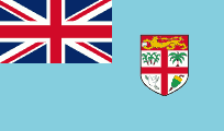
Flag of Fiji is a Blue Ensign with the shield from the National Coat of Arms
| Capital | Suva |
| Largest cities | Suva |
| Currency | Dollar |
| Highest point | Mount Tomanivi |
Fiji is an archipelago of more than 332 islands, of which 110 are permanently inhabited
Fiji has two major islands, Viti Levu and Vanua Levu
The capital and largest city, Suva, is on Viti Levu
The majority of Fiji's islands were formed through volcanic activity starting around 150 million years ago
Kiribati
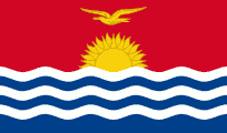
Flag of Kiribati has a gold frigate bird
| Capital | South Tawara |
| Largest cities | South Tawara |
| Currency | Australian dollar |
| Highest point | Banaba |
The Gilbert Islands became independent from the UK as Kiribati in 1979
Kiribati comprises 32 atolls and one raised coral island, Banaba
Line Islands are a chain of eleven atolls and low coral islands in the central Pacific Ocean. Eight of the islands form part of Kiribati, while the remaining three are United States territories. Those that are part of Kiribati are in the world's farthest forward time zone, UTC+14:00
The capital and now most populated area, South Tarawa, consists of a number of islets, connected by a series of causeways. These comprise about half the area of Tarawa Atoll
Kiribati is the only country that is situated within all four hemispheres
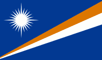
Marshall Islands
| Capital | Majuro |
| Largest cities | Majuro |
| Currency | US dollar |
| Highest point | Likiep |
Marshall Islands are named after Captain John Marshall from Ramsgate, who visited the islands in 1788
Marshall Islands are part of the larger island group of Micronesia
The most populous atoll is Majuro, which also acts as the capital
The largest nuclear test the U.S. ever conducted, code named “Castle Bravo”, took place at Bikini Atoll
With the 1952 test of the first U.S. hydrogen bomb, code named "Ivy Mike", the island of Elugelab in the Enewetak atoll was destroyed
Federated States of Micronesia
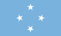
The four stars on the flag of the Federated States of Micronesia represent the states in the federation
| Capital | Palikir |
| Largest cities | Weno |
| Currency | US dollar |
| Highest point | Mount Nanlaud |
Federated States of Micronesia is an independent sovereign island nation and a United States associated state consisting of four states – from west to east, Yap, Chuuk, Pohnpei and Kosrae – that are spread across the Western Pacific Ocean
The capital is Palikir, located on Pohnpei Island, while the largest city is Weno, located in the Chuuk Atoll
Federated States of Micronesia is spread across part of the Caroline Islands in the wider region of Micronesia
Nan Madol is an archaeological site on Pohnpei, and is a UNESCO World Heritage Site
Nauru
| Capital | Yaren (or Yaren District) |
| Largest cities | Denigomodu |
| Currency | Australian dollar |
| Highest point | Command Ridge |
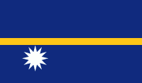
Nauru is an island country in Micronesia. Its nearest neighbour is Banaba Island in Kiribati
Nauru was formerly known as Pleasant Island
Nauru is a phosphate rock island with rich deposits near the surface, which allow easy strip mining operations. It has some phosphate resources which are not now economically viable for extraction. The phosphate reserves on Nauru are now almost entirely depleted
To earn income, Nauru briefly became a tax haven and illegal money laundering centre. From 2001 to 2008, and again from 2012, it accepted aid from the Australian Government in exchange for hosting the Nauru detention centre
Nauru is the smallest republic in the world
Yaren is usually listed as the capital of Nauru. However, the republic does not have cities or an official capital. Yaren is accepted by the United Nations as the "main district"
New Zealand
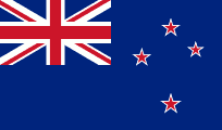
Flag of New Zealand has four red stars centred within four white stars, representing the Southern Cross
| Capital | Wellington |
| Largest cities | Auckland, Christchurch, Wellington, Hamilton |
| Currency | Dollar |
| Highest point | Aoraki / Mount Cook |
Aotearoa is the Maori name for New Zealand. Means “the land of the long white cloud”
The two main islands of New Zealand (the North Island, or Te Ika-a-Māui, and the South Island, or Te Waipounamu) are separated by the Cook Strait
South Island is the larger island
North Island is the more populous
Stewart Island / Rakiura is the third largest island of New Zealand. It lies 30 km south of the South Island, across Foveaux Strait. Its permanent population is slightly over 400 people, most of whom live in the settlement of Oban
Auckland is the largest city in New Zealand
Auckland was established in 1840. Named for George Eden, Earl of Auckland, British First Lord of the Admiralty
Sky Tower is an observation and telecommunications tower located in Auckland. It is 328 m tall, as measured from ground level to the top of the mast, making it the tallest man-made structure in the Southern Hemisphere
Wellington is the capital city and second most populous urban area. It is located at the southwestern tip of the North Island
Beehive is the common name for the Executive Wing of the New Zealand Parliament Buildings in Wellington
Christchurch is the largest city in the South Island of New Zealand, and the country's third-most populous urban area
River Avon flows through Christchurch
Cardboard Cathedral is a transitional cathedral, replacing ChristChurch Cathedral, which was significantly damaged in the 2011 Christchurch earthquake. It was designed by the Japanese architect Shigeru Ban
Rotorua is a city on the southern shores of the lake of the same name, in the Bay of Plenty Region of North Island. It is known for its geothermal activity, and features geysers – notably the Pohutu Geyser. Known as “Sulphur City”
Napier was rebuilt in Art Deco style after an earthquake in 1931
Dunedin is the second-largest city in the South Island, and the principal city of the Otago Region. The name comes from Dùn Èideann, the Scottish Gaelic name for Edinburgh
Dunedin is the furthest city in the world from London
Baldwin Street in Dunedin claims to be the world’s steepest residential street, although this is challenged by Ffordd Pen Llech in Harlech, Wales
Queenstown in Otago is an adventure tourism resort. Kawarau Gorge Suspension Bridge was the world's first commercial bungy jumping site
Bay of Islands is on North Island. Home of the first Maori settlers, and site of the signing of the Treaty of Waitangi
Aoraki / Mount Cook lies in the Southern Alps, the mountain range which runs the length of the South Island. Aoraki means “cloud piercer”
Lake Taupo is the largest lake by surface area in New Zealand
Mount Ruapehu is an active stratovolcano at the southern end of the Taupo Volcanic Zone, within the Tongariro National Park. It is the largest active volcano in New Zealand
Lake Hauroko is located in a mountain valley in Fiordland National Park in the South Island. The long S-shaped lake is 463 m deep. It is New Zealand's deepest lake
Cape Farewell is the most northerly point on the South Island
Firth of Thames is a large bay located in the north of the North Island
Waikato River is the longest river in New Zealand
Tasman Glacier is the longest glacier in New Zealand. It lies entirely within the borders of Aoraki/Mount Cook National Park
Fox Glacier and Franz Josef Glacier are on the west coast of New Zealand
Milford Sound is a fiord in the south west of South Island, within Fiordland National Park. Milford Sound sports two permanent waterfalls all year round, Lady Bowen Falls and Stirling Falls
Doubtful Sound is a fiord in Fiordland
Coramandel Peninsula extends north from the Bay of Plenty
Frying Pan Lake is the world’s largest hot spring
States in free association with New Zealand
Cook Islands
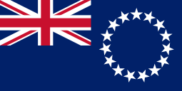
The stars on the flag of the Cook Islands represent the fifteen islands that make up the Cook Islands
The Cook Islands' defence and foreign affairs are the responsibility of New Zealand.
The main population centres are on the island of Rarotonga. Avarua is the capital
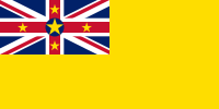
Niue
Niue is the largest coral island in the world. Known as the “Rock of Polynesia”. Though self-governing, Niue lacks full sovereignty. In 2003, Niue became the world's first ‘WiFi nation’, in which free wireless Internet access is provided throughout the country
Alofi is the capital
In 2020 Niue became the first whole country to become an International Dark Sky Place
Dependent territories of New Zealand
Tokelau
Tokelau is a dependent territory of New Zealand in the South Pacific Ocean that consists of three tropical coral atolls
New Zealand outlying islands are nine offshore island groups that are part of New Zealand. The islands are all uninhabited except the Chatham Islands
Chatham Islands
Have officially belonged to New Zealand since 1842. They cover a total of 966 km², most of which is in the two main islands, Chatham Island and Pitt Island. Chatham Island is the fourth largest island of New Zealand. Chatham Islands observe their own time, 45 minutes ahead of New Zealand time. The islands include New Zealand's easternmost point, the Forty-Fours
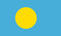
Palau
| Capital | Ngerulmud |
| Largest cities | Koror City |
| Currency | US dollar |
| Highest point | Mount Ngerchelchuus |
Palau is part of the larger island group of Micronesia, and is spread across the Caroline Islands
The most populous island is Koror. The capital Ngerulmud is located in Melekeok State on the nearby island of Babeldaob
Palau became an independent country in 1994
Jellyfish Lake in Palau is notable for the millions of golden jellyfish which migrate horizontally across the lake daily
Papua New Guinea
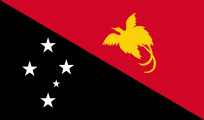
Flag of Papua New Guinea depicts a kumul Bird of Paradise and the Southern Cross
| Capital | Port Moresby |
| Largest cities | Port Moresby, Lae |
| Currency | Kina |
| Highest point | Mount Wilhelm |
The eastern part of New Guinea forms the mainland of Papua New Guinea, which has been an independent country since 1975. It was formerly a territory governed by Australia
Lae is the largest cargo port in Papua New Guinea
Owen Stanley Range is a mountain range in Papua New Guinea
Bismarck Range is a mountain range in the central highlands of Papua New Guinea; the highest point is Mount Wilhelm
Carteret Islands are located near Bougainville in the South Pacific. The atoll is a scattering of low lying islands in a horseshoe shape. The islands have progressively become uninhabitable, due to flooding
New Britain is the largest island in the Bismarck Archipelago (named after Otto von Bismarck) of Papua New Guinea. The island was part of German New Guinea
848 languages are listed for the country
Sepik and Fly are the longest rivers. Fly is the largest river by discharge in Oceania
Trobriand Islands are an archipelago of coral atolls off the east coast of New Guinea
Raggiana Bird of Paradise is known as a kumul in New Guinea
Samoa
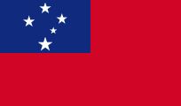
Flag of Samoa depicts the Southern Cross
| Capital | Apia |
| Largest cities | Apia |
| Currency | Tala |
| Highest point | Mount Silisili |
Samoa became independent from New Zealand in 1962
Western Samoa was the first independent Pacific island. It changed its name to Samoa in 1997
The two main islands of Samoa are Upolu and Savai'i. The capital city, Apia, is situated on the island of Upolu. The islands are seperated by the Apolima Strait
Samoa changed to driving on the left hand side of the road in 2009
The International Date Line was moved to the east of the country in 2011
Solomon Islands
| Capital | Honiara |
| Largest cities | Honiara |
| Currency | Dollar |
| Highest point | Mount Popomanaseu |
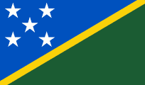
Solomon Islands lie to the east of Papua New Guinea and northwest of Vanuatu
Guadalcanal is the largest of Solomon Islands. It hosts the nation's capital, Honiara
Solomon Islands should not be confused with the Solomon Islands archipelago, which is a collection of Melanesian islands that includes Solomon Islands and Bougainville Island (part of Papua New Guinea), but excludes the nation's outlying islands
Named after the biblical king Solomon
King Charles III is the Monarch of the Solomon Islands and the head of state; he is represented by the Governor-General
Tonga
| Capital | Nuku’alofa |
| Largest cities | Nuku’alofa |
| Currency | Pa’anga |
| Highest point | Kao |
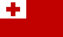
Tonga became known as the Friendly Islands because of the friendly reception accorded to Captain James Cook on his first visit there in 1773
Tonga is the only Polynesian kingdom. It has never lost its sovereignty to a foreign power
The largest island, Tongatapu, on which the capital city of Nukuʻalofa is located, covers 257 km2
Free Wesleyan Church is the largest Methodist denomination in Tonga
Tupou VI is the King of Tonga
Tuvalu
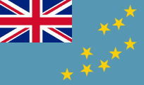
Flag of Tuvalu is a blue ensign with nine stars representing the nine islands
| Capital | Funafuti |
| Largest cities | Funafuti |
| Currency | Dollar |
| Highest point | Niulakita |
The Ellice Islands became independent from the UK as Tuvalu in 1978
Tuvalu consists of three reef islands and six true atolls
Funafuti is an atoll on which the capital of Tuvalu is located
The capital of Tuvalu is sometimes given as Fongafale or Vaiaku, but the entire atoll of Funafuti is officially the capital
The ".tv" domain name generates around 8% of the government’s total revenue each year from royalties
Niulakita is 4.6m above sea level
Vanuatu
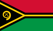
The emblem on the flag of Vanuatu is a golden boar’s tusk
| Capital | Port Vila |
| Largest cities | Port Vila |
| Currency | Vatu |
| Highest point | Mount Tabwemasana |
In the 1880s, France and the United Kingdom claimed parts of the archipelago, and in 1906 they agreed on a framework for jointly managing the archipelago as the New Hebrides through a British–French Condominium. An independence movement arose in the 1970s, and the Republic of Vanuatu was founded in 1980
Port Vila is located on the island of Efate
Tanna is an island of Vanuatu, and is at the centre of the Jon Frum cargo cult which worshipped Prince Philip, the Duke of Edinburgh
Mount Yasur is an active volcano on Tanna
Ambrym is a volcanic island in Vanuatu. Volcanic activity on the island includes lava lakes in two craters near the summit
Espiritu Santo is the largest island in Vanuatu
Other territories
American Samoa
American Samoa is an unincorporated territory of the United States
The largest and most populous island is Tutuila
Pago Pago is the capital, Fagatogo is the seat of government
Bougainville
Louis-Antoine de Bougainville's name is given to Bougainville which is geographically part of the Solomon Islands, but politically Papua New Guinea; and to the strait which divides it from the island of Choiseul
In a 2019 referendum Bougainville voted for independence from Papua New Guinea. As a result, the regional authorities intend to become independent between 2025 and 2027, pending ratification by the Papua New Guinean government
Caroline Islands
Caroline Islands are a widely scattered archipelago of tiny islands to the north of New Guinea. Politically they are divided between the Federated States of Micronesia and Palau. Historically, this area was also called New Philippines
Easter Island
Easter Island was given its common name of ‘Easter’ because the first recorded European visit by a Dutch Admiral Jacob Roggeveen was on Easter Sunday, 1722. The island's official Spanish name Isla de Pasqua is a direct translation of ‘Easter Island’. The current Polynesian name of the island, Rapa Nui or ‘Big Rapa’, was coined by labour immigrants from Rapa in the Bass Islands
Easter Island is a special territory of Chile that was annexed in 1888
Hanga Roa is the main town, capital and harbour of Easter Island
Moai are 887 monolithic human figures carved by the Rapa Nui people on Easter Island between the years 1250 and 1500. The more recent moai had hats of red volcanic stone known as pukao on their heads, which represent the topknot of the chieftains
French Polynesia
French Polynesia is made up of six groups of islands. The largest and most populated island is Tahiti, in the Society Islands. The other island groups are: Marquesas Islands, Tuamotu Archipelago, Gambier Islands, Austral Islands and Bass Islands
Papeete, on Tahiti, is the capital of French Polynesia
Bora Bora and Moorea are islands in the Society Islands archipelago
Society Islands are divided into Leeward Islands and Windward Islands
Moruroa is an atoll which forms part of the Tuamotu Archipelago in French Polynesia. France undertook nuclear weapon tests between 1966 and 1996 at Moruroa
Marquesas Islands are a group of volcanic islands in French Polynesia, an overseas collectivity of France
Mariana Islands
Mariana Islands are an arc-shaped archipelago made up by the summits of fifteen volcanic mountains in the Pacific Ocean. They are composed of two administrative units, Guam, a US territory, and the Northern Mariana Islands (including the islands of Saipan, Tinian and Rota) which make up a Commonwealth of the United States
Guam was discovered by Ferdinand Magellan, and was formerly a Spanish territory
Guam is the largest and southernmost of the Mariana Islands. The capital is Hagatna
Challenger Deep is the deepest known point in the Earth's sea floor hydrosphere, with a depth of 10,898 m. It is in the Pacific Ocean, at the southern end of the Mariana Trench near the Mariana Islands group
Mariana Trench belongs jointly to a commonwealth of the United States and Federated States of Micronesia
Pitcairn Islands
Pitcairn Islands are a group of four volcanic islands in the southern Pacific Ocean that form the last British Overseas Territory in the Pacific. The four islands are Pitcairn, Henderson, Ducie, and Oeno
Adamstown is the only settlement on, and as such, the capital of, the Pitcairn Islands
Adamstown has a population of 56, which is the entire population of the Pitcairn Islands: all the other islands in the group are uninhabited
Henderson Island is the largest of the Pitcairn Islands
Point Nemo is the oceanic pole of inaccessibility. It lies in the South Pacific Ocean, 2,700 from the nearest land, Ducie Island, that is part of the Pitcairn Islands
Wake Island
Wake Island is an unorganized, unincorporated territory of the United States in Micronesia
Access to the island is restricted, and all activities on the island are managed by the United States Air Force. There is also a missile launch facility operated by the U.S. Missile Defense Agency
Wallis and Futuna
Wallis and Futuna islands lie between Fiji and Samoa and are a French overseas collectivity
The territory is made up of three main volcanic tropical islands
Mata-Utu is the capital and largest city
New Caledonia
New Caledonia is a special collectivity of France located in the southwest Pacific Ocean. The archipelago, part of the Melanesia subregion, includes the main island of Grande Terre. The capital of the territory is Noumea
Prince Edward Islands
Prince Edward Islands are two small islands in the sub-Antarctic Indian Ocean that are part of South Africa
French Southern and Antarctic Lands
Overseas Territory of France. Includes Adelie Land (the French claim on Antarctica), Kerguelen Islands, and groups of islands around Madagascar
Antarctica
Antarctica has the highest average elevation of all the continents
Australia has the largest territorial claim by area in Antarctica
Belief by Europeans in the existence of a Terra Australis – a vast continent in the far south of the globe to balance the northern lands of Europe, Asia and North Africa – had existed as an intellectual concept since classical antiquity
Antarctica is considered a desert, with annual precipitation of only 200 mm along the coast and far less inland
Antarctica is nearly twice the size of Australia. About 98% of Antarctica is covered by ice that averages 1.9 km in thickness, which extends to all but the northernmost reaches of the Antarctic Peninsula. The large volume of ice present stores around 70% of the world's fresh water
British Antarctic Territory is a British overseas territory, the sector of Antarctica claimed by the United Kingdom from the South Pole to 60° south latitude between longitudes 20° west and 80° west. Before 1962, the area now covered by the Territory comprised three separate dependencies of the Falkland Islands; Graham Land, the South Orkney Islands, and the South Shetland Islands
Deception Island is an island in the South Shetland Islands
Ross Dependency is a region of Antarctica defined by a sector originating at the South Pole, passing along longitudes 160° east to 150° west, and terminating at latitude 60° south. It is claimed by New Zealand
Graham Land and Palmer Land are the northern and southern portions of the Antarctic Peninsula
Amundsen–Scott South Pole Station was built by the United States Government during 1956 as a part of its commitment to the scientific goals of the International Geophysical Year
Kaiser Wilhelm II Land (also Wilhelm II Coast) is part of Antarctica
Scott's Hut is a building located on the north shore of Cape Evans on Ross Island in Antarctica. It was erected in 1911 by the British Antarctic Expedition of 1910–1913 (also known as the Terra Nova Expedition) led by Robert Falcon Scott
Scott Base is a New Zealand research facility on Ross Island
Mount Ellsworth and Lake Ellsworth are named after American polar explorer Lincoln Ellsworth
Halley Research Station, run by the British Antarctic Survey, is located on the Brunt Ice Shelf floating on the Weddell Sea. It is the first fully relocatable research station in the world
Queen Maud Land is claimed by Norway as a dependent territory. Named after the Norwegian queen Maud of Wales
Marie Byrd Land is the largest unclaimed territory on Earth. It was named after the wife of American naval officer and explorer Richard E. Byrd
Onyx River is the longest river
McMurdo Dry Valleys are a row of largely snow-free valleys, located within Victoria Land
Argentina and Chile have civilian settlements
The world’s most remote post office can be found in Port Lockroy
Mountains
The three largest mountain ranges on the Antarctic continent are the Transantarctic Mountains, the West Antarctica Ranges, and the East Antarctica Ranges
Highest mountains – Vinson Massif, Mount Tyree, Mount Shinn
Vinson Massif lies in the Sentinel Range of the Ellsworth Mountains, which stand above the Ronne Ice Shelf near the base of the Antarctic Peninsula
Mount Erebus is the southernmost active volcano on Earth. With a summit elevation of 3795 m, it is located on Ross Island. Mount Erebus was first climbed (to the rim) by members of Sir Ernest Shackleton's party in 1908. Mount Erebus was discovered in1841 by polar explorer James Clark Ross who named it Mount Erebus after his ships, Erebus and Terror. Erebus was a primordial Greek god of darkness, the son of Chaos
Mount McClintock is part of the Australian Antarctic Territory, and is higher than all peaks of Australia, including all external territories
Lakes
Lake Vostok is the largest of more than 140 subglacial lakes found under the surface of Antarctica. It is located beneath Russia's Vostok Station, 4,000 m under the surface of the central Antarctic ice sheet
Lake Ellsworth is a subglacial lake located in West Antarctica under approximately 3.4 km of ice
Lake Vida is a hypersaline lake. It came to public attention in 2002 when microbes frozen in its ice cover for more than 2,800 years were successfully thawed and reanimated
Seas
Weddell Sea is an area along the east side of the Antarctic Peninsula. Named after British sailor James Weddell
Larsen Ice Shelf is a long ice shelf in the northwest part of the Weddell Sea
Bellingshausen Sea is an area along the west side of the Antarctic Peninsula. It takes its name from Russian explorer Admiral Bellingshausen, who explored in the area in 1821
Alexander Island is the largest island of Antarctica. It lies in the Bellingshausen Sea
Amundsen Sea lies to the south of the Bellingshausen Sea
Ross Sea is a deep bay of the Southern Ocean between Victoria Land and Marie Byrd Land
McMurdo Sound opens into the Ross Sea to the north
Wilkins Sound is largely occupied by the Wilkins Ice Shelf. In 2009 the thin bridge of ice to the Wilkins Ice Shelf off the coast of Antarctica splintered, and scientists expect it could cause the collapse of the Shelf
Shackleton Ice Shelf is an extensive ice shelf fronting the coast of East Antarctica
Glaciers
Lambert Glacier is in East Antarctica. At about 60 miles wide, over 250 miles long, and about 2,500 m deep, it is the world's largest glacier
Beardmore Glacier has a length exceeding 160 km. The glacier is one of the main passages from the Ross Ice Shelf through the Queen Alexandra and Commonwealth ranges of the Transantarctic Mountains to the Antarctic Plateau, and was one of the early routes to the South Pole. The glacier was discovered by Ernest Shackleton during his Nimrod Antarctic expedition of 1908

